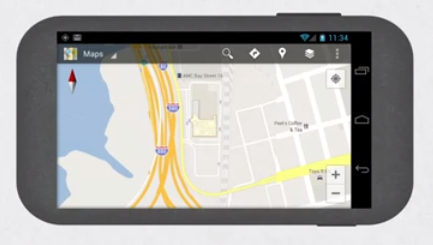
Google announce today that the upgrade of its maps application to 6.0 would include floor plans.
The upgrade will only be for Android devices, but the idea behind the upgrade is intriguing. People always use their phones to get themselves to the right location, so now you can use your phone to do something like figuring out your next exhibit stop in a museum.
Having the right directions may have just become a bit easier, but how will the phones hold up in bigger cities?
Not sure about everyone else out there but I’ve tried using google maps in a big city to help get me from point A to point B. I remember fondly my whole trip to New York City over the summer– every time I pulled out my phone to see if I was going the right way the small navigator arrow said I was inside a building when I was actually standing in the street. Hopefully this has been fixed or else this new upgrade could be a waste of data.
To watch google’s video on maps 6.0 Click HERE!
If you’re reading this on your android device and you want to try out the upgrade Click HERE!


